Riding Introduction
Historical Election Results in 2008
Voting Results | View Map of Results
Electoral District Profile
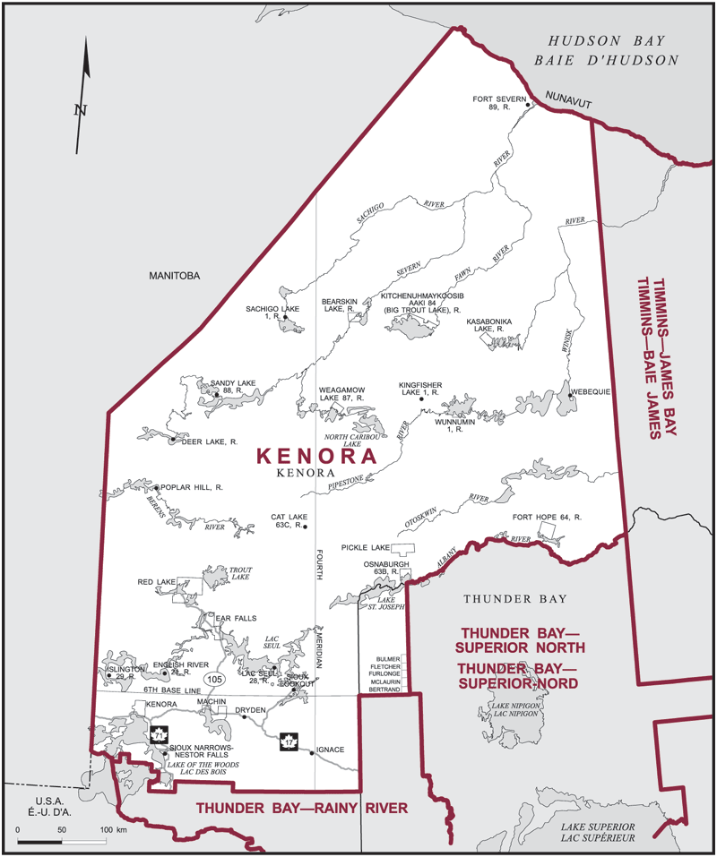
The electoral district of Kenora (Ontario) covers an area of 321,716 km2, and has a population of 64,291 with 42,036 registered voters and 138 polling divisions.
Consisting of:
(a) that part of the Territorial District of Kenora lying westerly of a line described as follows: commencing at the northeast corner of the most northerly point of the Territorial District of Thunder Bay (Albany River); thence due north to the northerly boundary of the Province of Ontario; and
(b) that part of the Territorial District of Thunder Bay lying northerly and westerly of a line described as follows: commencing at the intersection of the westerly limit of said territorial district with the 6th Base Line; thence easterly along said base line to the southeast corner of the geographic Township of Bertrand; thence northerly along the easterly boundary of the geographic townships of Bertrand, McLaurin, Furlonge, Fletcher and Bulmer to the northeast corner of the aforementioned geographic township; thence due north to the northerly limit of said territorial district.
Downloads
- Boundary Map (gif | pdf)
- Poll-by-Poll Results Raw Data (csv)
- Statistics (Statistics Canada | BC Stats)