Riding Introduction
Historical Election Results in 2008
Voting Results | View Map of Results
Electoral District Profile
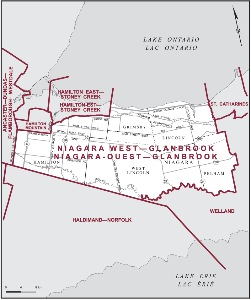
The electoral district of Niagara West--Glanbrook (Ontario) covers an area of 1,080 km2, and has a population of 111,024 with 89,763 registered voters and 210 polling divisions.
Consisting of:
(a) that part of the City of Hamilton lying easterly and southerly of a line described as follows: commencing at the intersection of the southerly limit of said city with Glancaster Road; thence northerly along said road and its intermittent production to the hydroelectric transmission line situated southerly of Rymal Road West; thence easterly along said transmission line to Glover Road; thence northerly along said road, Anchor Road, Arbour Road and its intermittent production to Mountain Brow Boulevard; thence northerly along said boulevard to Redhill Creek; thence easterly along said creek to the Niagara Escarpment; thence generally easterly along said escarpment to the easterly limit of said city; and
(b) that part of the Regional Municipality of Niagara comprised of: the towns of Grimsby, Lincoln and Pelham; the Township of West Lincoln.
Downloads
- Boundary Map (gif | pdf)
- Poll-by-Poll Results Raw Data (csv)
- Statistics (Statistics Canada | BC Stats)