Riding Introduction
Historical Election Results in 2008
Voting Results | View Map of Results
Electoral District Profile
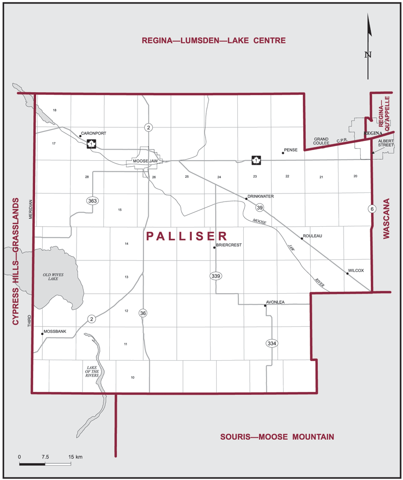
The electoral district of Palliser (Saskatchewan) covers an area of 7,778 km2, and has a population of 65,956 with 50,175 registered voters and 142 polling divisions.
The electoral district's boundaries are described as, consisting of those parts of the Province of Saskatchewan and the City of Regina described as follows: commencing at the southeast corner of Tp 10 R 22 W 2; thence west along the south boundary of Tp 10 to the Third Meridian; thence north along said meridian to the north boundary of Tp 18; thence east along the north boundary of Tp 18 to the east boundary of R 22 W 2; thence south along the east boundary of R 22 W 2 to the Canadian Pacific Railway in Tp 17; thence easterly along said railway to the westerly limit of the Village of Grand Coulee; thence southerly, easterly and northerly along the westerly, southerly and easterly limits of said village to said railway; thence easterly along said railway to Albert Street in the City of Regina; thence southerly along said street and Highway No. 6 to the south boundary of Tp 13; thence west along the south boundary of Tp 13 to the east boundary of R 22 W 2; thence south along the east boundary of R 22 W 2 to the point of commencement.
Downloads
- Boundary Map (gif | pdf)
- Poll-by-Poll Results Raw Data (csv)
- Statistics (Statistics Canada | BC Stats)