Riding Introduction
Historical Election Results in 2008
Voting Results | View Map of Results
Electoral District Profile
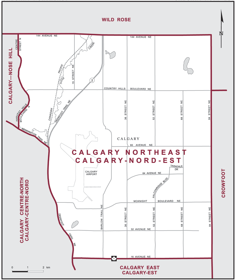
The electoral district of Calgary Northeast (Alberta) covers an area of 127 km2, and has a population of 129,015 with 86,083 registered voters and 213 polling divisions.
The electoral district's boundaries are described as, consisting of that part of the City of Calgary lying northerly and easterly of a line described as follows: commencing at the intersection of the easterly limit of said city with 16 Avenue NE (Highway No. 1); thence westerly along said avenue to Deerfoot Trail NE (Highway No. 2); thence northerly along said trail to Beddington Trail NE; thence northwesterly along Beddington Trail NE to Harvest Hills Boulevard N; thence northerly along said boulevard, its proposed extension (as per Section 6 of Calgary Land Use Bylaw 2P80 of March 31, 1980) to Centre Street N; thence northerly along said street to the northerly limit of said city.
Downloads
- Boundary Map (gif | pdf)
- Poll-by-Poll Results Raw Data (csv)
- Statistics (Statistics Canada | BC Stats)