Riding Introduction
Historical Election Results in 2008
Voting Results | View Map of Results
Electoral District Profile
The electoral district of Calgary Centre (Alberta) covers an area of 42 km2, and has a population of 124,197 with 89,322 registered voters and 230 polling divisions.
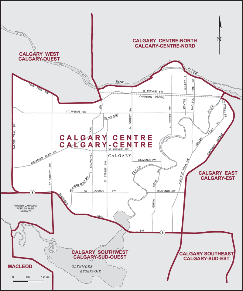
The electoral district's boundaries are described as, consisting of that part of the City of Calgary described as follows: commencing at the northeast corner of the former Canadian Forces Base Calgary; thence west along the westerly limit of said city to Glenmore Trail SW; thence westerly along said trail to Sarcee Trail SW; thence northerly along Sarcee Trail SW to Bow Trail SW; thence generally easterly along Bow Trail SW to Crowchild Trail SW (Highway No. 1A); thence northerly along Crowchild Trail SW (Highway No. 1A) to the right bank of the Bow River; thence generally easterly along said bank to the right bank of the Elbow River; thence southerly along said bank to the Canadian Pacific Railway; thence generally southerly along said railway to Glenmore Trail SW; thence generally westerly along said trail to 37 Street SW; thence southerly along said street to the point of commencement.
Downloads
- Boundary Map (gif | pdf)
- Poll-by-Poll Results Raw Data (csv)
- Statistics (Statistics Canada | BC Stats)