Riding Introduction
Historical Election Results in 2008
Voting Results | View Map of Results
Electoral District Profile
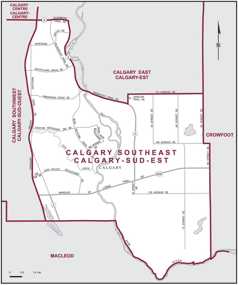
The electoral district of Calgary Southeast (Alberta) covers an area of 119 km2, and has a population of 125,738 with 104,941 registered voters and 235 polling divisions.
The electoral district's boundaries are described as, consisting of that part of the City of Calgary lying easterly and southerly of a line described as follows: commencing at the intersection of the southerly limit of said city with the Canadian Pacific Railway; thence northerly along said railway to Glenmore Trail SE (Highway No. 8); thence easterly along said trail to Deerfoot Trail SE (Highway No. 2); thence generally southeasterly along Deerfoot Trail SE to Barlow Trail SE; thence northerly along Barlow Trail SE to 114 Avenue SE; thence easterly along said avenue to the easterly limit of said city.
Downloads
- Boundary Map (gif | pdf)
- Poll-by-Poll Results Raw Data (csv)
- Statistics (Statistics Canada | BC Stats)