Riding Introduction
Historical Election Results in 2008
Voting Results | View Map of Results
Electoral District Profile
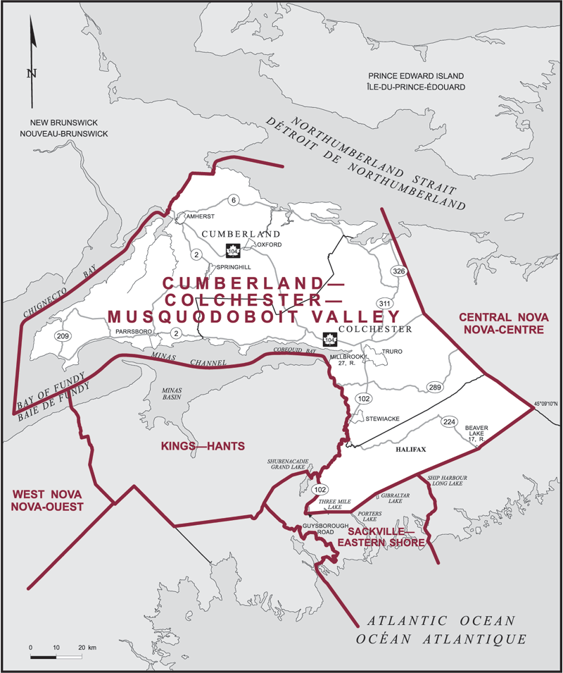
The electoral district of Cumberland--Colchester--Musquodoboit Valley (Nova Scotia) covers an area of 10,086 km2, and has a population of 87,895 with 69,188 registered voters and 215 polling divisions.
The electoral district's boundaries are described as, consisting of:
(a) the counties of Cumberland and Colchester; and
(b) that part of the Halifax Regional Municipality lying easterly and northerly of a line described as follows: commencing at the intersection of Highway No. 102 with the northerly limit of said regional municipality; thence generally southerly along said highway and Highway No. 118 to Guysborough Road; thence easterly in a straight line for approximately 8.6 km to a point in Three Mile Lake at latitude 44°48'27''N and longitude 63°29'29''W; thence easterly in a straight line for approximately 9.2 km to the most northerly extremity of Porters Lake; thence northeasterly in a straight line for approximately 11.9 km to the most northwesterly extremity of Gibraltar Lake; thence northeasterly in a straight line to the most northwesterly extremity of Ship Harbour Long Lake; thence northeasterly in a straight line to a point located on Highway No. 224 and the easterly boundary of Beaver Lake Indian Reserve No. 17; thence northeasterly along said boundary to its northeasterly corner; thence northeasterly in a straight line to the intersection of the easterly limit of the Halifax Regional Municipality with the line of latitude 45°09'10''N.
Downloads
- Boundary Map (gif | pdf)
- Poll-by-Poll Results Raw Data (csv)
- Statistics (Statistics Canada | BC Stats)