Riding Introduction
Historical Election Results in 2008
Voting Results | View Map of Results
Electoral District Profile
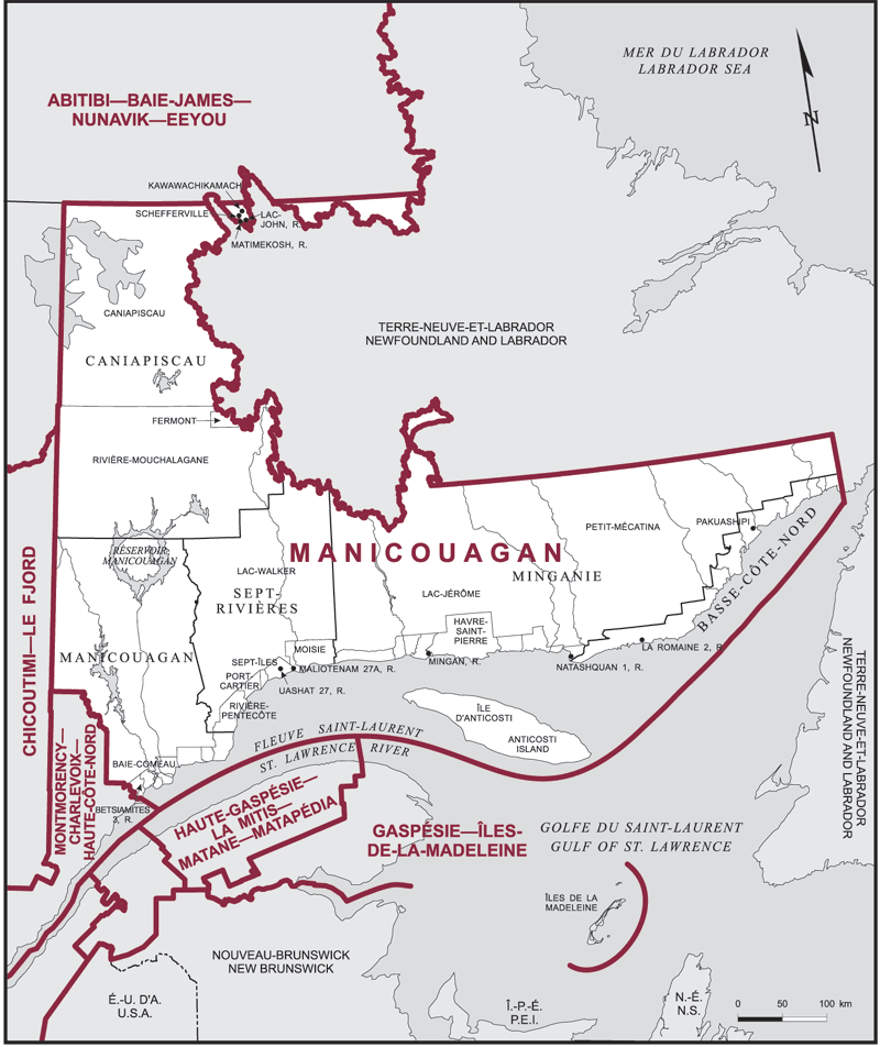
The electoral district of Manicouagan (Quebec) covers an area of 252,365 km2, and has a population of 83,220 with 65,648 registered voters and 188 polling divisions.
Consisting of:
(a) the Regional County Municipality of Caniapiscau, including: Lac-John and Matimekosh Indian reserves; the Reserved Land of Kawawachikamach;
(b) the Regional County Municipality of Minganie, including Mingan Indian Reserve and Natashquan Indian Reserve No. 1;
(c) the Regional County Municipality of Sept-Rivières, including Maliotenam Indian Reserve No. 27A and Uashat Indian Reserve No. 27;
(d) the Regional County Municipality of Manicouagan, including Betsiamites Indian Reserve No. 3; and
(e) the Equivalent Territory of Basse-Côte-Nord, including: La Romaine Indian Reserve No. 2; the Indian Settlement of Pakuashipi.
Downloads
- Boundary Map (gif | pdf)
- Poll-by-Poll Results Raw Data (csv)
- Statistics (Statistics Canada | BC Stats)