Riding Introduction
Historical Election Results in 2008
Voting Results | View Map of Results
Electoral District Profile
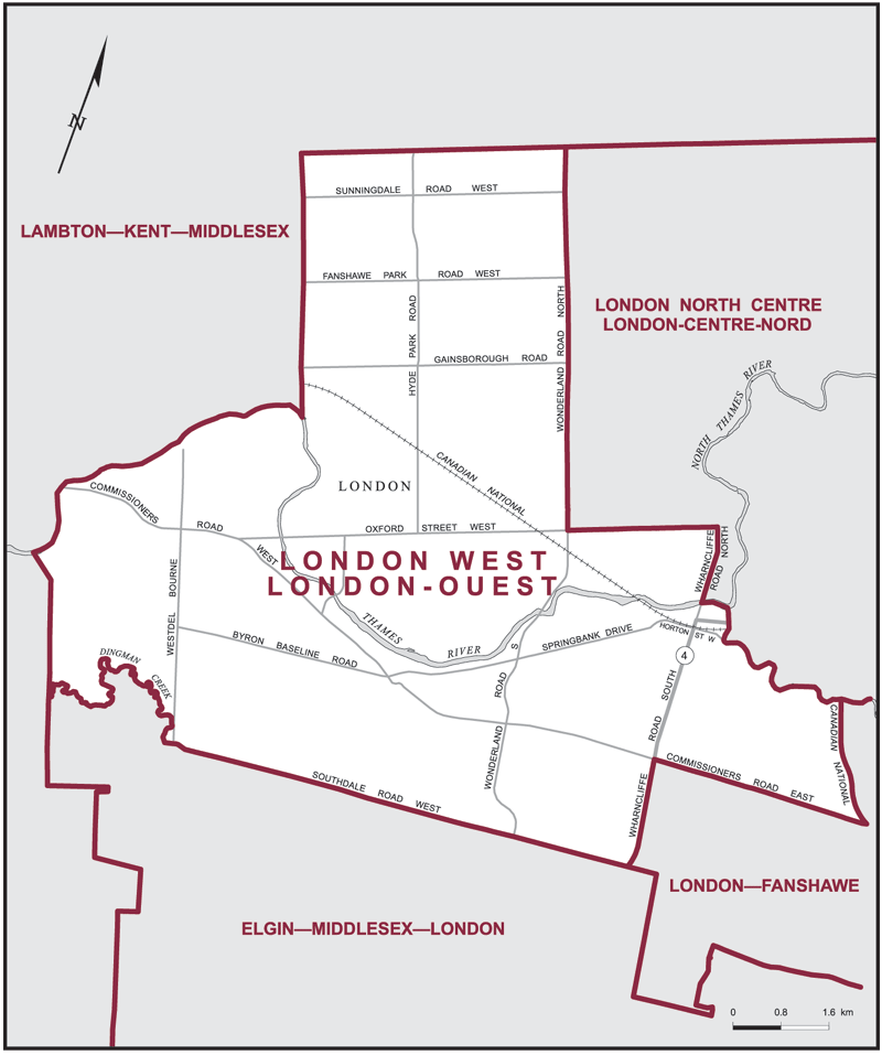
The electoral district of London West (Ontario) covers an area of 86 km2, and has a population of 118,335 with 93,915 registered voters and 240 polling divisions.
Consisting of that part of the County of Middlesex comprised of that part of the City of London described as follows: commencing at the intersection of the westerly limit of said city with Dingman Creek; thence generally easterly along said creek to the westerly production of Southdale Road West; thence easterly along said production and Southdale Road West to Wharncliffe Road South; thence northerly along Wharncliffe Road South to Commissioners Road East; thence easterly along Commissioners Road East to the Canadian National Railway; thence northerly along said railway to the Thames River (South Branch); thence generally westerly along said river and Thames River to Wharncliffe Road North; thence northerly along said road to Oxford Street West; thence westerly along said street to Wonderland Road North; thence northerly along said road to the northerly limit of said city; thence generally southwesterly along the northerly and westerly limits of said city to the point of commencement.
Downloads
- Boundary Map (gif | pdf)
- Poll-by-Poll Results Raw Data (csv)
- Statistics (Statistics Canada | BC Stats)