Riding Introduction
Historical Election Results in 2008
Voting Results | View Map of Results
Electoral District Profile
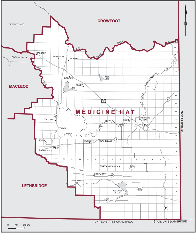
The electoral district of Medicine Hat (Alberta) covers an area of 33,305 km2, and has a population of 113,085 with 82,599 registered voters and 203 polling divisions.
The electoral district's boundaries are described as, consisting of that part of the Province of Alberta described as follows: commencing at the intersection of the south boundary of said province with the westerly limit of Forty Mile County No. 8; thence generally northwesterly along said limit to the southerly limit of the Municipal District of Taber; thence generally northwesterly and generally northeasterly along the southerly, westerly and northerly limits of said municipal district to the right bank of the Bow River; thence generally northwesterly along said bank to the southeasterly corner of Siksika Indian Reserve No. 146; thence generally northerly and westerly along the easterly and northerly boundaries of said Indian reserve to the easterly limit of Wheatland County; thence generally northeasterly along the southeasterly limit of said county to the right bank of the Red Deer River; thence generally easterly along said bank to the east boundary of said province; thence south and west along the east and south boundaries of said province to the point of commencement.
Downloads
- Boundary Map (gif | pdf)
- Poll-by-Poll Results Raw Data (csv)
- Statistics (Statistics Canada | BC Stats)